 Face
Face
Face
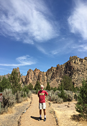
FaceSmith Rock climbing area is tucked away about five miles east of the main highway through Central Oregon, which is Hwy 97. This climber's paradise is around 25 miles north of Bend. Its geology is very volcanic, from about 28 million years ago and again 400,000 year ago from Newberry Crater; rhyolite and tuff rocks predominate. Notable routes and trails include: the infamous Monkey Face, Morning Glory Wall, Mesa Verde Wall, Wombat, The Monument, Shiprock, Cathedral Rock, Koala Rock, Opposum, First Kiss, the Marsupials, Misery Ridge, among zillions of other routes. Don't neglect the huckleberry ice cream at the rustic Juniper Junction near the Park's entrance. And in nearby Terrebonne there's well-stocked Redpoint Climbers Supply, on the east side of the highway. And for belly-filling food, there's Base Camp Pizza nearby.
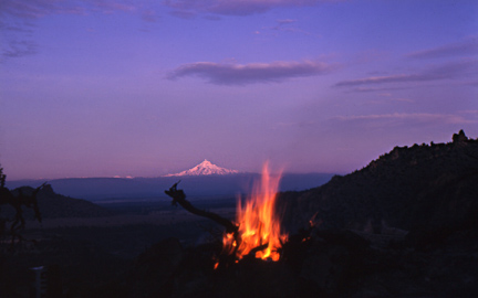
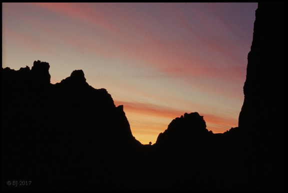
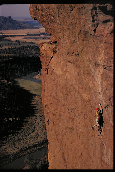
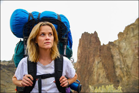
Image above: sunrise from Misery Ridge. Oregon's second-highest peak, Mt. Jefferson shines in the dawn light. All the major Cascade peaks from Mt. Hood to the Three Sisters and Mt. Bachelor are spectacularly visible from the ridgetop trails at Smith Rock... Picture note: image is from long, long ago, before current strict State Park regulations about such things. The 652 acre Park itself was formed by land acquisitions between 1960 and 1975, so it's possible that my campsite was not even in the Park at the time... Also, in my defense, this was winter and fire danger was very low. The Park is open year-round due to its very dry climate, but be aware that winter can be very cold, with occasional cold waves where temps can go well below zero (F). Camping is allowed in a climbers "Bivouac" area for a very modest fee. Image below: This spectacular area has occasionally been used in location shots for films, most notably in the 2014 film "Wild," starring Reese Withspoon, one of my absolute favorite inspirational films. There she is, with her infamous pack named "Monster." In the film, she and her crew actually hike down the steep trail to the Crooked River, cross it, and shoot a scene under the cliffs on the other side, at a spot that I myself am very familiar with.
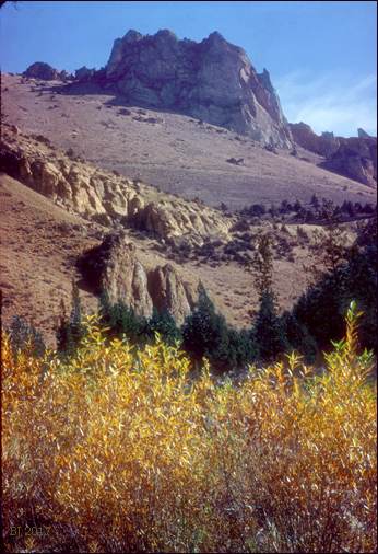
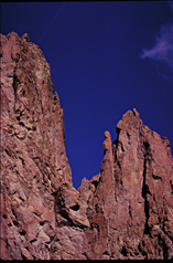
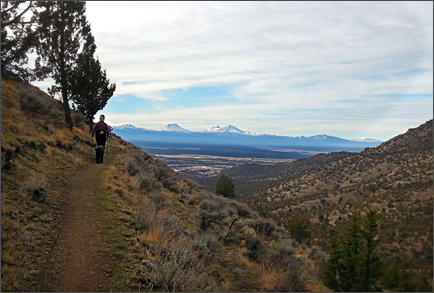
Ah, for those good 'ole days when Park regulations were few. Here I was camped beside the Crooked River at the north end of the Park. There are willows and Ponderosa pines along the water's edge, and lots of quiet in this early October shot. Above looms The Wombat. The slash across the hillside is what is called the Burma Road. It services both ends of a 3500 ft. long tunnel that carries the irrigation water of the "Central Oregon Canal." The tunnel and canal were built "by 1907" according to the website of the Central Oregon Irrigation District. The canal begins in Bend where Deschutes River water is diverted, and ultimately goes all the way into the Madras area; the canal and its sister canal the "Pilot Butte Canal" are the absolute lifeblood of all those green fields one sees in Central Oregon-- before 1900, everything was desert. Below: hiking into Smith Rock from the north on the Gray Butte trail.
Below: The Monument appears in the small image below (right side)