This view reveals the north side of the summit pinancle of Oregon's second highest peak. This is the view of the pinancle commonly seen by climbers coming up the difficult Jefferson Park Glacier Route (Grade II-4, first ascent 1933).
My mother still has no clue how close her eldest son came to buying it that morning.........
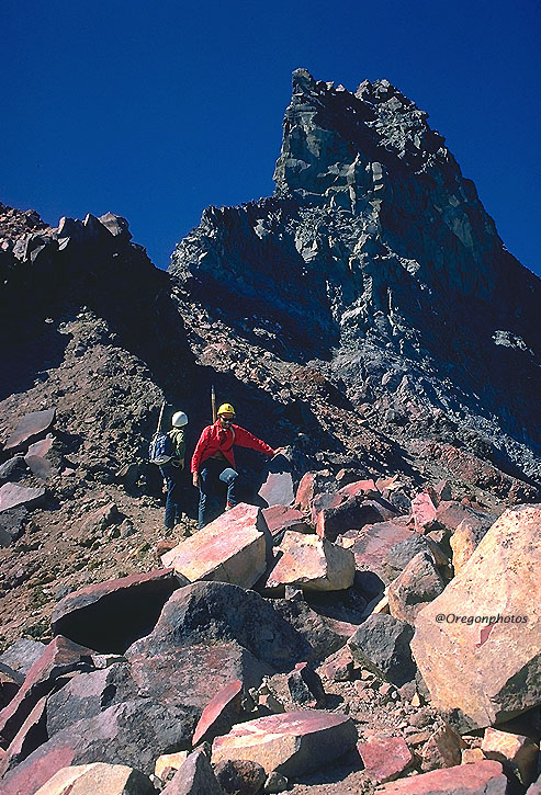
Bill and Jefferson, my climbing buddies that year, are oozing relief in this picture after an endless morning of sheer terror on the roasting hot East Face Route (Grade II-3, first ascent 1922, A Climber's Guide to Oregon notes wryly, "...some rock fall danger on this route.")...... We'd been climbing since dawn, far beyond our abilities, and the rockfall had been fierce. The snow had been too soft to permit the use of the ice pitons we had purchased just for this climb, so we'd climbed without protection in a broiling heat composed of five parts strong sunshine, five parts adrenaline, and ten parts fear. That's why, to my companions, this precipitous col at 10,000 ft was a haven and sanctuary of the highest order. But, as Leader, I looked upward at the summit pinnancle, and knew our troubles weren't over yet.
Note: The Mt. Jefferson Wilderness Area was established was a designated "Primitive Area" in 1930, and formally designated as a Wilderness Area on 10/2/1968. It's one of Oregon's larger wilderness areas at a size of 100,208 acres that spreads across the Deschutes, Mt. Hood, and Willamette Forests; it's the only Oregon Wilderness area to be managed by three different Forests.