We are looking
back to the very beginnings of climate reporting in the Portland
area, circa 1874.
If interested in Portland's
recent severe winter cold waves, click here.
Tidbit:
1888 was one of the most
brutal winters ever experienced in the Portland area. The mean
temperature for January 1888 was an even 22.0 degrees F, which
is 16.1 degrees below normal, equivalent to raising the city to
4800 feet-- the elevation of Santiam Pass! Other historic records
indicate that December 1884 had very deep snows followed by subzero
cold and huge losses of livestock and other damage, and was remembered
as the "worst ever" for many decades later.
Tidbit:
Frozen Rivers! There are several instances in the historic records
of the Willamette and Columbia Rivers freezing over, with ice
jams and icebreakers at work on the rivers to keep the Port of
Portland open! There are even pictures of cars being driven across
the icy Willamette River in downtown Portland, eg. December,
1924. Even far to the south of Portland, The Oregonian newspaper
noted on Dec. 24 that the Willamette River was frozen to the depth
of seven inches in Eugene! 1933 also froze the Columbia,
and may have been the most recent occurrence of this.
Winter 1949 and Winter 1950
The winters of both 1949 and 1950
provided residents with two back-to-back horrific winters, which
shattered many records, combining both extreme cold and deep snowfalls.
Most of those marks were so extreme that they are still easily
standing today, eg. in the extreme cold category, the average daily low
in January 1949 was 21.0 degrees, and in January 1950 it was 21.2
degrees, both breaking the old "coldest month" record
that had been set in 1888, and both marks still standing tall
in 2016 as "coldest ever." Since
1950, the only cold even approaching these records was January
1985, when the mean monthly temperature was 26.8. But in the cold
category, the really outstanding events of Winter 1950 were two out
of the three times in history that Portland has been below zero!
Portland's all-time record low was set on February 2, 1950 at 3 below zero. Salem's
second-coldest all-time low of 10 below was set on January 31,
1950 (Salem's absolute lowest is 12 below).
Deep
and long-lasting snows! The
winters of 1949 and 1950 gave stunned residents the experience
of living in true "Snow Belt" cities, with weeks-long
snow on the ground, and many very cold days with snow deeper than
10 inches on the ground....January 1950's snowfall dwarfs modern
contenders, with an awesome 41 inches falling during the long,
cold month (the much-touted heavy snows of Decemer 2008
totalled only about half of 1950's)...... Also of interest regarding
the winter of 1949 is the little-known fact that a very unusual
early-season cold invasion occurred approx. October 19-21, 1949,
setting all-time record lows for the dates that in 2011 have still
not been beaten-- such low temp. records are found for cities
ranging all up and down the West Coast, from Olympia, WA (23 degrees),
to Portland, Oregon (27 degrees), to Medford, Oregon (20 degrees),
to Sacramento, Calif.(35 degrees)-- and even as far south as Douglas,
Arizona on the Mexican border (31 degrees)....This type of major
cold air invasion was similar to the range and power to the Siberian Express of
February, 1933, which set all-time cold records across several
States that have never been beaten. It was also similar to the
freak Nov. 15, 1955 cold wave that pushed Olympia, WA to zero
degrees establishing a record that still easily beats its closest
contender since.
The Big Picture of Historic Long-term
Portland Snowfalls, compliments of Steve Pierce, AMS: During
the period of 1871 to the present, Portland's all-time records
for snowfall include, at number one, the winter of 1892-93, with
60.9 inches of snow.... The winter of 1949-50 came in third with
a total of 44.5 inches, while winter 2008-2009 is (as of
January 14) only in 20th place, with a total of 21.3 inches.
Within the past ten years, the next-highest contender was the
winter of 2003-2004, with 12.3 inches. Global Warming is highly suspect in a long-term analysis Mr. Pierce did
of Portland snowfall by decade, beginning in 1871. That analysis
showed a pronounced and steady decline in Portland snowfall over
the period from 1871 to 2010. The earliest decade having 183 inches of snowfall, while the 2000-2010 decade recorded only
45 inches, a four-fold decrease, and one which
clearly supports the unscientific "feelings" of many
Portlanders oldtimers that their city rarely gets any significant
snow anymore.
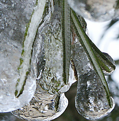
Ice Storm 2004 was decidedly puny in comparison to many
of the cold and snow events in Portland's historic record, for
example January of 1950, or the winter of 1968-69 (see below)....The
winter of 1919-1920 is still a record-holder in many categories
(see below)
1950--- During the brutal winter of
1949-50 there was an entire month when the Portland area lay under
a deep blanket of snow over a foot deep. Janary, 1950 buried the
City with a total snowfall at the Airport of 41 inches! The unbelievable
month ended in a record-setting cold wave, which on January 31
gave Portland a new all-time record low of 2 below zero, then
promptly broke that on February 2, freezing the City with Portland's all-time record low of
3 below zero. Here are
some quotations:
(January, 1950)
"Temeratures over the entire State were far below normal,
and precipitation was much above. The major portion of this precipitation
fell in the form of snow and sleet even in the western division
(eg. Willamette Valley). In Portland a total of 32.9 inches of
snow fell during the month (41 inches at the Airport)...Severe
blizzard conditions on the 13th and a heavy sleet and ice storm
on the 18th-19th together caused several hundred thousand dollars
worth of damage and virtually halted traffic for two or three
days over widespread areas, particularly in western Oregon...."
George Taylor adds, "...All highways west of the Cascades
and through the Columbia River Gorge were closed due to large
snow drifts." (First quote is from the 1950 Annual Climatological
Summary, written by E.S. Ellison, and second quotation is from
The Oregon Weather Book by George Taylor. ) And Portland
was mild compared to what was happening eastward up the Columbia
River Gorge, where the cold and snow were worse yet, with Cascade
Locks buried under 92 inches of snowfall for the month, and the
town of Hood River nearly shut down with 94 inches. Further east
up the Gorge, the normally semi-arid town of The Dalles saw an
unbelievable 76 inches fall during the month.
1968-69--- Finally, bringing us to a more
recent time, let's not forget the winter of 1968-69. This winter
featured a brutal double-whammy of snow in late-December-January....
In total there were 18 days with one inch or more of snow on the
ground, with snow up to 9 inches deep during the first period,
and up to 10 inches deep in the second! Kids were in heaven and
snowmen almost out-numbered people by the time the long snowy
period ended.... While temperatures were not as extremely cold
as in either 1949 or 1950, they were substantially colder than
Portland's Ice Storm of 2004. eg. Dec. 30, 1968 had a high of
14 and a low of 8, and Dec. 31, 1968, had a high of only 19 and
a low of 9 degrees; in contrast, the coldest recorded during Ice
Storm 2004 was a comparatively mild 18 degrees....Overall, winter
1968-69 ended with a total snowfall of 34.0 inches, ranking it
in the Number 9 spot since records began in 1871..... Also of
note, and more recent yet, was the cold wave of Christmas 1978,
which extended also into early January 1979.
December,
1919.
Apologies to all other contenders, but December of 1919 is still
the Grand-daddy of winter storms in Oregon--- the year still holds
various records for both extreme cold and for deep snow! What
may be Oregon's record for "The most snow in 24 hrs. in an
actual town" was probably set on December 10, 1919, when
40 inches smothered Parkdale, a small town in the apple-growing
region above Hood River. Also of note was Parkdale's 63 inch storm
total from the three-day storm. Completing the horrendous winter
picture, very severe cold in arctic outbreaks hit the State, especially
Dec. 11-16, and weather observers of the time noted that the Columbia
River was frozen and winter had not even arrived yet!.. December
13, 1919 saw Austin at 41 below zero, and the same date saw Pendleton
shivering with 28 below (which is tied with Feb. 1929 for that
city's all-time record low). Overall, winter 1919-1920 saw only
19 inches of snow fall in Portland itself, but it stayed on the
ground for a very long time due to the frigid temperatures. In
contrast to Portland, nearby Forest Grove was really clobbered
by heavy snowfall--- a single 48 hour period (Dec. 9-10) saw 25
inches of snow fall-- dry, light stuff, and then temperatures
went sub-zero for four days, as low as 15 below! In the 100 years
since, no storm of such magnitude has struck Northwestern Oregon
(deep snows, extreme cold, and long duration).
Has Global Warming been the Culprit?
1990-- the last
really cold December recorded in Portland. Coldest day had high
of 20 and low of 12.
1983-- but Christmas-time
1983 will long be remembered as much worse than 1990. For many
days the east winds whistled at consistent 40-50 mph, while episodes
of rain, snow and fog messed up all transportation. Temperatures
for the 12-14 days of the cold wave were not quite as cold as
what would occur in 1989, but with the extreme winds were brutal,
eg. Dec. 23 with a high of only 19, a low of 12, and winds gusting
to 48 mph! This cold wave featured a terrible ice storm that began
on Christmas Day and lasted for the next several days. Could not
have been worse timing by Mother Nature!
1980-- the last
really cold January recorded in Portland. Coldest day had high
of 32 and low of 13.
1989-- the last
really cold February recorded in Portland. Coldest days were Feb.
2 and 3, with frigid highs of 15 and.18, and
lows of 9 and 11, then Feb. 5 also hit a low of 9... (amazingly,
January 30th had had a high of a balmy 56 degrees, and early January
had gotten as high as 60!)
Early December
of 2013 featured a quite significant Arctic blast for Oregon,
although Portland was not the hardest hit (click here for more)
Below are
some interesting early and late dates of hot and cold during Portland's
weather year cycle:
Earliest mid-70's
temperature: March 13, 2005, 75 degrees, during a long spell of
nearly cloudless similar days!
Earliest mid-80s
temperature: April 26, 1947, 86 degrees.
Earliest 90 degree
temperature: April 30, 1998, 90 degrees.
Latest mid-80s
temperature: October 11, 1991, 86 degrees.
Latest 80 degree
temperature: October 15, 1991, 80 degrees.
Latest 70 degree
temperature: November 13, 1991, 71 degrees.
Earliest frost:
October 8, 1985, 32 degrees (Seneca was 4 degrees!).
Earliest 20 degrees
or less temperature: November 12, 1978, 19 degrees (Seneca was
8 below zero)
Earliest 15 degrees
or less temperature: 13 degrees on November 15, 1955 (east of
the Cascade Mtns., Pendleton was 4 below zero, while Seneca fell
to an unbelievable 31 below zero! Meanwhile in Washington State
an astounding 3 degrees was recorded on the shores of Puget Sound
in Olympia----comment: the early season cold wave of November
1955 caused much damage because it was so early and so severe
that few people had yet properly winterized their homes, vehicles,
etc.)
THANKSGIVING
COLD: Cold Wave of November, 1985---- in Western Washington, Olympia
had lows of zero, two days in a row, Nov. 22 and 23, a real frozen
turkey time! Meanwhile Portland recorded an cold but unremarkable
17, while Seattle had a chilling 10 degrees, and east of the Cascades
Yakima was 13 below zero...Oregon's Arctic King, Seneca, fell
to 31
below zero during
this early-season cold wave event.
Windstorms!
From
Steve Pierce at the AMS, Portland chapter: "Regional windstorm
expert Wolf Read, who recently spoke at the 2011, 19th Annual
Winter Weather Forecast Conference in Portland, has dedicated
a website to historical windstorms of the Pacific Northwest. Please
see full details on the 1981 windstorm (and others) at: http://www.climate.washington.edu/stormking/November1981.html
Back
to Ice Storm 2004 page
Back
to OregonPhotos.com main Oregon Climate page
Page Last Reviewed 08/28/2023