Wallowa
Mountains--
the Switzerland of Oregon (five pages)
Hidden in the
remote northeastern corner of Oregon is a land of Alps unlike
anywhere else in Oregon. Here you ascend deep u-shaped canyons
for 10-20 miles to reach the inner glacial sanctums of bare rock
and crystalline lakes. Your neck aches from gazing so steeply
upward at the 9,000+ peaks on either side, ears full of the sounds
of swift streams and distant waterfalls crashing down the steep
granite slopes of hanging valleys high above. The canyon vegetation
alternates pleasingly between a varied forest of pines and true
firs, and numerous resplendent meadows where the scent of wild
onion crushes underfoot. Outdoors writers like Mark Bagett report
that this region of Oregon supports a population of the rare and
exciting
Wolverine,
the ferocious "carcajou" of the Canadian Northwest Territories.
And in recent years, you may hear the sound of the wolf pack that
was introduced!
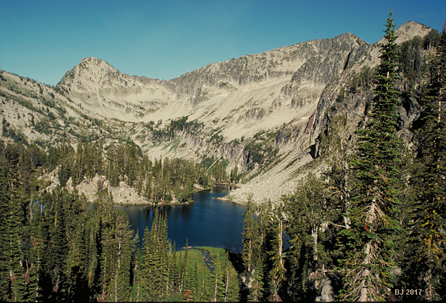
Pictured above
is Pop Lake, 7566' in the upper reaches of the Minam River drainage.
It's reached only via a faint, nearly abandoned trail over a 8050'
pass. The perfect lake nestles in hidden glory in its hanging
valley high above the Minam, with 9000 ft. Needle Point to its
east.
The Eagle Cap
Wildeness preserves the central portion of the Wallowa Mountains.
It was established as one of the first Oregon Primitive Areas
in 1930, and formally designated as one of Oregon's earliest Wilderness
Areas on 10/7/1940, at a size of 293,775 acres, since expanded
to 355,000 acres (Oregon's largest Wilderness). Just to the east
on the Idaho border lies the magnificent Hells Canyon Wilderness,
established 12/31/1975, a medium-sized Oregon wilderness area
at 108,900 acres (the Idaho portion of the Wilderness adds another
83,800 acres). For a map of all 40 of Oregon's wilderness areas,
please click
this link:
http://www.wilderness.net/index.cfm?fuse=NWPS&sec=stateView&state=or&map=orwest....
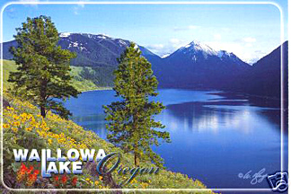
Pictured below is a scan of a historic postcard advertising the
Wallowas. I've since lost the card, but estimate this image is
at least 20 or 30 years old. It pictures the classic "tourist"
view of the Wallowas that helped to establish them as "Oregon's
Switzerland." This is the most-easily visited major viewpoint;
it's located at Wallowa Lake State Park, near the Mt. Howard tramway.
The picture is taken from the giant terminal moraine left by the
glacier which carved out Wallowa Lake!
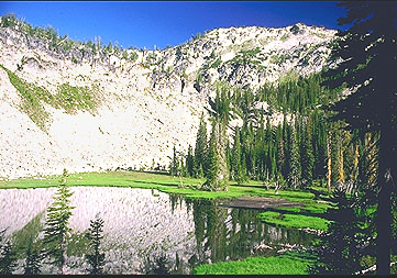
(below) Cached
Lake, 7,300 ft., Eagle Creek drainage (you must hike many miles
to get to this lake!). It is one of approximately 60 alpine lakes
in the Wilderness.
A quality of the
Wallowas so unlike the Cascades is the brillance of the light
that bathes them; their large expanses of gem-like, crystallized
metamorphic rocks catch and throw the high altitude sunlight in
an arresting manner similar to the High Sierras, John Muir's "Range
of Light."
The many creeks
and rushing rivers of the Wallowas are surprising since the surrounding
lowlands are so semi-arid.
Click on image
below for larger image
Prospect Lake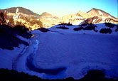 8,400 feet
Wallowas
as seen from the southwest deserts near Baker. Click to view more


Page
Last Revised January 2023