A characteristic of the Wallowas is their glacial-carved nature. Deep U-shaped canyons radiating outward from central peaks such as Eagle Cap. Permanent snowfields and even a residual glacier or two. Hanging valleys with myriad lakes, so many lakes! An abundance of water: creeks, streams, waterfalls, seeps, soggy meadows, bogs, springs -- and that rarity anywhere else in Eastern Oregon, genuine year-round rivers with pure waters, high volumes and great fly-fishing.
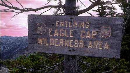
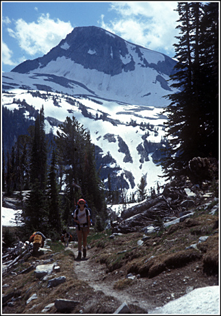
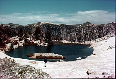
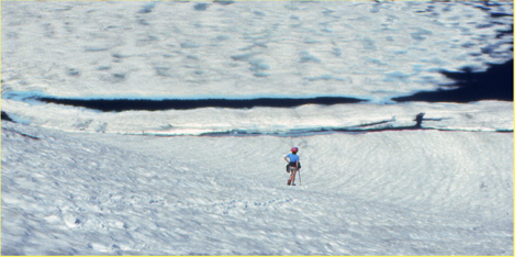
The pictures: top is an entry sign to the Wilderness, established 1964, currently at 355,000 acres in size. Next is entering the Lakes Basin with Eagle Cap dominating. Next is a nameless tarn at 8354 ft. on the Hurwal Divide 0.4 air miles up above Razz Lake (8110 ft, a steep climb to the tarn!). Last is a hiker coming down off a climb of Eagle Cap, skirting the shore of still-mostly-frozen Glacier Lake (8184 ft) in late July.