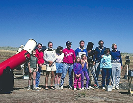
 From 1992 to the present (2014),
we have held OSP in the Ochoco Mountains near Prineville, Oregon,
not nearly so high and remote, but still very dark skies.From 1992 to the present (2014),
we have held OSP in the Ochoco Mountains near Prineville, Oregon,
not nearly so high and remote, but still very dark skies.
From 1992 to the present (2014),
we have held OSP in the Ochoco Mountains near Prineville, Oregon,
not nearly so high and remote, but still very dark skies.From 1992 to the present (2014),
we have held OSP in the Ochoco Mountains near Prineville, Oregon,
not nearly so high and remote, but still very dark skies.|
|
|
|
|
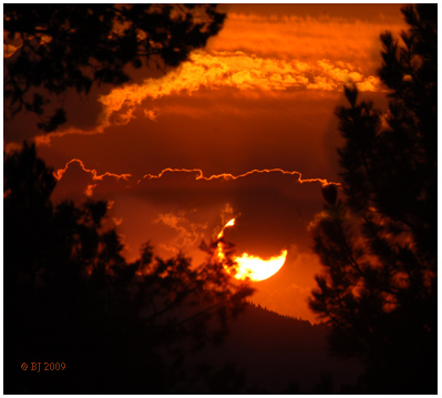 Sunset
|
|
|
|
|
|
|
|
|
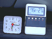 Typical
OSP late afternoon temperature and humidity are ideal! Your optics
stay dry at our 5,000 ft. site in the Ochoco Mountains of Central
Oregon! Sunburn Risk at OSP is high even though we typically hold
our event a full two months after Summer Solistice.
Typical
OSP late afternoon temperature and humidity are ideal! Your optics
stay dry at our 5,000 ft. site in the Ochoco Mountains of Central
Oregon! Sunburn Risk at OSP is high even though we typically hold
our event a full two months after Summer Solistice.Lovers of the out-of-doors delight in distant panoramas, but many have noticed with disappointment that days with crisp, clean air and fine distant panoramas are rarer and rarer all across the U.S...... historical accounts of early Oregon often mention the pleasing views of very distant mountain peaks available even from within the lowlands of the Willamette Valley, while early mountaineer's accounts mention feats of distant vision that astound the climbers of today, and which may never be rivalled again...... A good example are reports from such high points in Central Oregon as Paulina Peak that the major peaks from Oregon, California and Washington were all visible at one time, the minimum distance involved being 180 miles from 8,000 ft. Paulina Peak to 14,000 ft. Mt. Shasta in California, and 160 miles to 12,000 ft. Mt. Adams in Washington. (see below)
"Typical visual range in the eastern U.S. is 15 to 30 miles, or about one-third of what it would be without human caused air pollution. In the West, the typical visual range is 60 to 90 miles, or about one-half of the visual range under optimal natural conditions. Haze diminishes the natural visual range.
Haze is caused by fine particles that scatter and absorb light before it reaches the observer. As the number of fine particles increases, more light is absorbed and scattered, resulting in less clarity, color, and visual range." Source: Official Dept. of Agriculture Site: http://www.fsvisimages.com/viscause.html
Recently I came upon a really evocative article about the light pollution problem facing our World as a whole. The writer, Verlyn Klinkenborg, in this November 2008 National Geographic article, wrote:
"In most cities the sky looks as though it has been emptied of stars, leaving behind a vacant haze that mirrors our fear of dark and resembles the urban glow of dystopian science fiction. We've grown so used to this pervavsive orange haze that the original glory of an unlit night - dark enough for the planet Venus to throw shadows on Earth - is wholly beyond our experience, beyond memory almost. And yet above the city's pale ceiling, utterly undiminished by the light we waste - a bright shoal of stars and planets and galaxies, shining in seemingly infinite darkness."