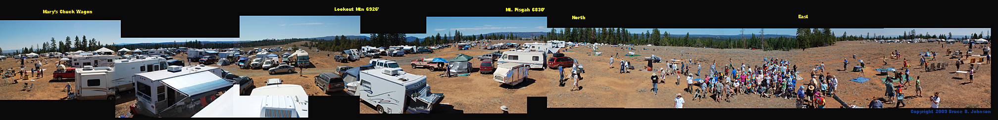
OSP 2009 Panorama of Indian Trail Springs Site: Compare to 1999 Panorama!
Use your scrolling arrows or bar on the bottom of screen to revolve the image through 360 degrees. Have Fun! The left edge of the image is aproximately Southeast. Our elevation is 5,030 ft. This panorama was taken about 3pm in the afternoon. The large white Meeting Tent marks approximate due South. What are the differences you see between the 1999 and the 2009 Panorama?* (My comment is after the next paragraph)... Be sure to go to page bottom to see an enlarged section of the panorama which focuses on the view toward Mary's Chuck Wagon!
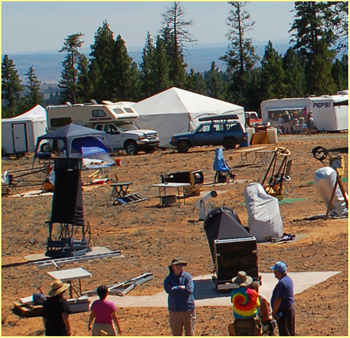
Barely visible in the south is the University of Oregon's Pine Mountain Observatory, about 45 air miles away (click for more on PMO)....The three highest points near OSP are visible-- to the west is the long mass of Lookout Mountain at just under 7,000 ft; to the north is the similarly long bulk of Mt. Pisgah, which is just under 6,900 ft.; and to the ENE is Spanish Peak, a bit higher than Pisgah.... Here's an Interesting Fact in OSP History--- during 1992 the upper reaches of Mt. Pisgah were explored and considered as an OSP site; there is a fantastic south-facing meadow at about 6,650 ft., but it was judged too small, and the roads are terrible (click for pictures!).....Picture Credit: one of this year's Speakers, Mr. Steve Coe, loaned me his RV roof so I could get high for picture-taking. Thank you, Steve!
* Comparing the 1999 panorama
to the 2009 panorama, my personal opinion is that there are a
lot more big RVs present around the Main Observing Field than
in 1999
Wes Stone, a longtime OSP observer, sent this about sleeping out under the stars. I liked it, and so I post it for all to enjoy:
Wes Stone
Chiloquin, OR
http://skytour.homestead.com
Below is a higher resolution version of the 2009 panorama. This focuses on the view southward, with Mary's Chuck Wagon on the right side of the picture, and the deep valley of the Crooked River and Paulina far below in the distance.