Do you feel the heat? It's hot today. "Only" in the low 90's today, July 5th. It is often much hotter, and several of Oregon's all-time records for HOT have been set at nearby Pelton Dam ( downstream along the Deschutes River, where there is official weather instrumentation)....For example, Pelton Dam has suffered Oregon's earliest 100 degree temperature, 101 degrees on May 6, 1992....Later in the summer, it has recorded 117 degrees, and I am sure has the potential to break Oregon's ancient All-time record high of 119, set back on August 10, 1898 in the town of Pendleton, and also on a similar date at Prineville, during the same spectacular heat wave (and far before the modern epoch of Global Warming)...... For other Oregon hot and cold records by month please click here).
Lake Billy Chinook was named for a Wasco Indian Scout from Warm Springs who guided the famous John C. Fremont expedition in 1843and 1844, just a few years before the bulk of the Oregon Trail settlers began to arrive in their wagon trains. Kit Carson was part of this expedition. Billy's life as a scout continued for many years afterward, for instance, in 1866, he, Dr. McKay and a band of Warm Springs tribesmen surprised and attacked a large band of Piute Indians in what is now Crook County. For related local Native American history, visit my material about Celilo Falls and Celilo Village.
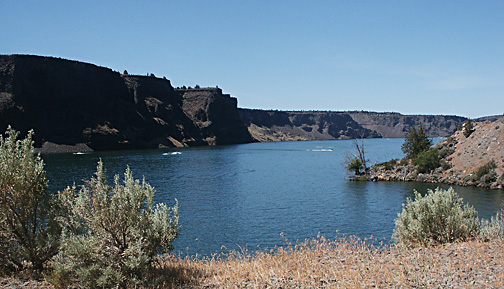
Lake Billy is deceptively small, its great volume of water tucked away into 3 long, skinny arms of up to about 13 miles long with a total of 72 miles of shoreline and an average depth of 102 feet. The lake was formed in 1964 by the building of the Round Butte Dam, which in one fell swoop damned the three major rivers of Central Oregon--- the Crooked River, the Deschutes River, and the ice-cold Metolius River. The Lake lists as 4,000 acres in size, but it is a very deep 4,000 acres, with water at the dam itself 415 feet deep! Such deep waters remain cool to cold even through the long hot summers, and giant lunkers can always drift into layers perfect for their needs. The Lake has a thriving and varied fishery, and holds Oregon's records for Bull Trout, aka Dolly Varden. The Kokanee salmon, aka Silver salmon, is known to be especially plentiful.
Stats tell that the Lake, when completely fully, contains enough water to supply over half a million families of four with all their water supplies for a full year! Another way to look at the Stats is to say that Lake Billy, if spread out into an evenly circular lake ten feet in depth, would be a lake a full 26 miles in diameter! Plunk that lake down onto the Portland Metro Area, and everything from :Hillsboro to Gresham is under ten feet of water, with several big islands jutting up like the West Hills and Rocky Butte!
 There
are two marinas on the Lake: Three Rivers, and one named for the
Cove Palisades. The U.S. Forest Service's "Perry South"
campground on the remote end of the Metolius River arm of the
Lake is ranked by the Forest Service as "the most popular
USFS campground in Oregon." And that despite it being a gruelling
30 miles drive off Highway 20, with twenty miles of that being
gravel road!
There
are two marinas on the Lake: Three Rivers, and one named for the
Cove Palisades. The U.S. Forest Service's "Perry South"
campground on the remote end of the Metolius River arm of the
Lake is ranked by the Forest Service as "the most popular
USFS campground in Oregon." And that despite it being a gruelling
30 miles drive off Highway 20, with twenty miles of that being
gravel road!
There are also three State Parks and a great KOA campground near the Lake. The image to the left was taken at one of the State Park Group campgrounds.