"Phantom Trails of the Santiam Canyon"
"Unfolded before me are Willamette
National Forest maps from 1937 and
1948, rescued from obscurity with knowledge unleashed like the
first beams
of the equinox through the portals of Stonehenge. Here was a world
ruled by
trails, where the glacial power of Mt. Jefferson flowed unchallenged
through
a towering expanse of old-growth forest. The Santiam Highway was
a single
track, treacherous and forbidding, perched on the canyon wall
where the dam
is today. The view dropping off into the canyon is still etched
into the
minds of old-timers. Turnouts were few, driving and negotiating
skills were
honed when two cars had to pass each other."
"Detroit, originally a logging camp, was the hub of an extensive
trail
network that included shelters and suspension bridges that were
in use until
the 1960's. Lookout points surrounded the area, with phone lines
that came
down into Mill City, Detroit, and Idanha. The Santiam River had
a trail on
the south bank starting at Detroit that went up as far as Pamelia
Creek.
According to local legend, pack strings of horses carried hay
bales in to
Pamelia Lake to dam the subterranean outflow and raise the water
level.
Controversy has raged intermittently about the history of the
tilted logs in
the lake. In the Marion Forks area, the Santiam River Trail was
improved
with rockwork bridges apparently built by the Civilian Conservation
Corps,
and at a lake close to the river, a floating log cabin was seen.
Prior to
1964, you could drive within 1/2 mile of Marion Lake, where there
was a
boathouse, docks, and rustic cabins. Dr. A. G. Prill had a cabin
on the
north side of the lake; only the fireplace hearth remains. A lost
passage
over Minto Mountain allowed access to the Skyline Trail, the predecessor
to
the Pacific Crest Trail, which was scouted by mountain guide Dee
Wright in
1896. He later oversaw the construction of the observatory on
the McKenzie
Pass by the CCC."
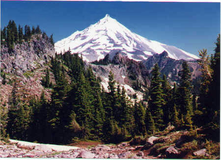
"Indian trails are still visible south of The Table
formation of Mt.
Jefferson, crossing the Cascade crest into eastern Oregon. Underneath
the Santiam Highway lies an Indian trail, a haunting presence
felt in twilight
moments, when past and present merge into the timelessness of
the canyon. In the wind is the sound of a forgotten traveler,
cresting a ridge of long ago."
In the image to the left, the old Indian trail is faintly seen as it leaves the Cascade crest and heads downward and eastward. It is the faint track of brownish soil just to the right of center at the image's bottom... See below (2nd. Picture) for a better look at the trail as it traverses a slope on its journey down to Table Lake.
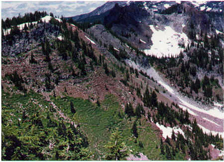
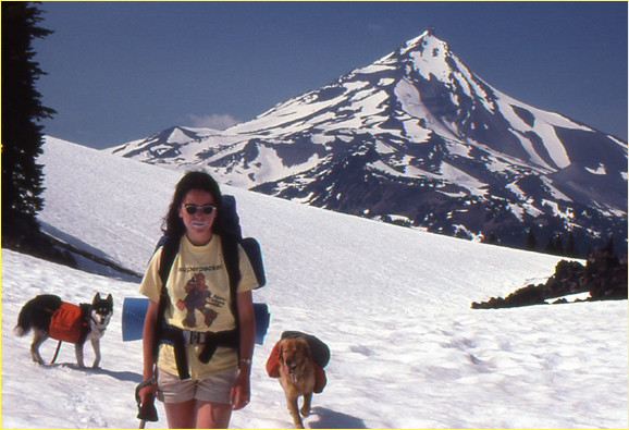
Here the old trail is seen as the faint trace across the greenery, slanting downward across the bottom third of the picture. Also shown are Cathederal Rocks and Goat Peak..The trail elevation as it cuts diagonally across the hillside is at 6000 feet. Note: the Indian trail lies just a mile or two north of the hiker picture at top of this page.
..... Here are exciting Update Notes, September, 2009. The time is now six years post-B&B Fire, so allow me to add more current information about this historic Indian Trail. In ancient times, it connected Hank and Hunts Lakes on the west side with Table Lake on the east side. In a sense, it probably connected Pamelia Lake with the dry canyons of the Metolius River and Warm Springs... THE GOOD NEWS is that my recent close examination of post-B&B Fire satellite imagery revealed that the area around this historic trail was untouched by the Fire. Hurrah! In fact, I was even able to faintly discern the old trail slashing across the mountainside, just as in the photo above! (and again in satellite photos 2022). In fact, I was able to trace the faint trail tread all the way to Table Lake! To contact me with pictures or reports, use: brucej@oregonphotos.com
To View more writing by J.D. Adams, click to read his piece entitled "The Wind."