 above
Panorama Point
above
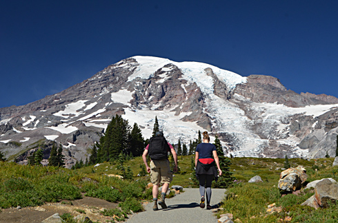
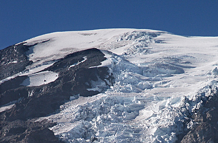
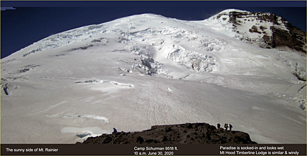
Panorama PointMy first cruise through Mt. Rainier National Park came in early summer 2007. It followed the typical tourist route from Hwy 12, White Pass, entering the Park at the Stevens Canyon entrance, thence up to Paradise Lodge, and down to the southwest entrance at Longmire, then out of the Park to nearby Ashford-- home of the Whittakers' Rainier Guide Service.....On a later visit, a late September visit, I was shocked at the magnificence of the huge peak's "other side," the north side of Rainier is smothered in giant glaciers above large expanses of timberline parklands. That side is most easily accessed during the summer months by a paved road up to 6,400 foot high "Sunrise." The facilities there kinda remind me of a mini version of Mt. Hood's Timberline Lodge. Here's a view of from 9500 ft. high Camp Schurman on that side of the mountain. You're looking at the massive Emmons Glacier on the northeast side of the peak. This side of the mountain is often sunny when the south and west sides are socked-in; it's a rain shadow effect.
In the image below Rainier rises to its full glory of 14,10 feet. Mists swirl around the peak, as is so often the case with this massive peak in this moist Pacific Northwest climate. Only moments before, the area where I stood had been swathed in a near-whiteout for over two hours. This is a image special effect known as "film noir." Do you like it? (link to my Mt. Hood pages, Oregon's highest peak)
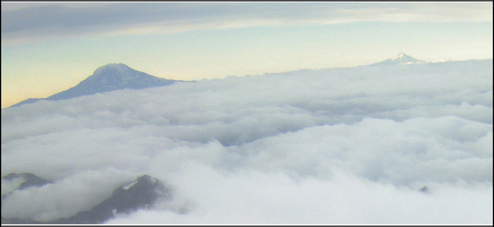
You would think Oregon's highest peak, Mt. Hood, could be easily spotted from Paradise Lodge at 5400 ft. but actually it takes climbing to 10,000 ft. Camp Muir to spot Hood, 105 miles away. And even then, it's a rare day at Muir where you can pierce that 105 miles of atmospheric haze and dust. Below was that rare day of clarity. Mt. Adams is on the left at 46 miles distance (scroll image).
Famed climber Willi Unsoeld, a Northwest native son, met his end on Mt. Rainier in 1987, when an avalanche swept him away. He is most known for making the first ascent of Mt. Everest's West Ridge during the ground-breaking American expedition of 1963.
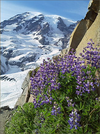
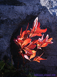
Below image was taken on September 30th, 2009, high above Paradise Lodge and the Visitor Center. I title it "Huckleberry Flame." Below that is an image I took from Puyallup on a summer day. I call it "Rainier- Mist Lord."
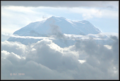 Mist Lord
It's a Puget Sound climatological fact that persistent low clouds often hang over the Puget Sound area, even in the summertime. Views of mighty Tahoma are often difficult to come by, as in the view above, taken in late June, which was the best view achieved of the mountain during the course of a long June day. On such days, the mountain itself is usually gloriously clear, floating high above the clouds all day long.
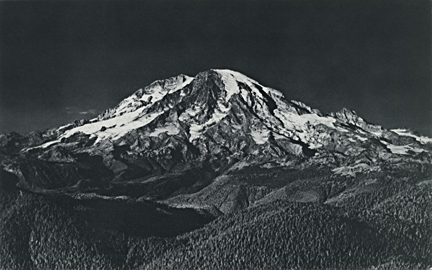
Above black and white image was taken by the founder of MSR in about 1935 (Mountain Safety Research). Founder Larry Penberthy was quite a photographer in his young adulthood, and self-published a 48 page book named "Holden Copper Mine" in 1997 (I own a copy).... The 8.5 x 11" book showcases his late 1930s photography, which dealt with the early history of mining in the North Cascades. Most of those images related to the Holden mine, where he himself worked in the late 1930s. The mine was high in the mountains just west of Lake Chelan.