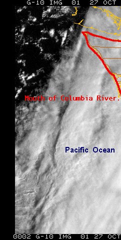
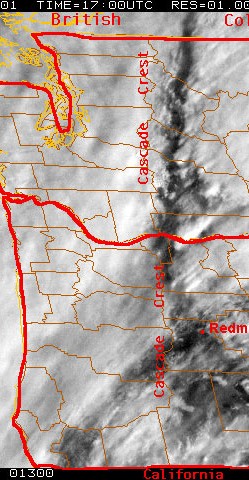
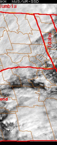
George Taylor, Oregon State Climatologist, calls this remarkable satellite image a prime example of "downslope" conditions---- whereas in Western Oregon and Western Washington, skies are gray and it is raining, in a narrow "Rift" zone just to the east of the Cascade Mountain crest, there are blue skies and sunshine for hundreds of miles from the interior of British Columbia all the way down to the California border! Why do the clouds part so dramatically, and then regroup themselves so quickly in the regions further eastward from the Rift? Why are places like Redmond and the RedmondTypical-Clouds.html airport thus so exceptionally favored with sunshine and clear skies? The exact answers are not entirely clear, but it is clear the Rift is involved in Redmond being somewhat drier than most of the towns and villages further east. Any amateur or professional weather folks who have a good theory are welcome to email me.